
What Is UAV Photogrammetry?
UAV photogrammetry is a method of collecting and processing aerial imagery captured by drones to create measurable spatial data, 2D maps, and 3D models. In drone photogrammetry, overlapping images are analyzed with reconstruction algorithms to generate accurate digital representations of terrain, infrastructure, and physical assets. Businesses use this technology for mapping, surveying, inspection, monitoring, and geospatial analysis across industries where fast and repeatable data collection is important.
The adoption of drone-based photogrammetry has grown rapidly due to advances in UAV hardware, camera sensors, GNSS positioning, and processing software. Modern drones for photogrammetry can capture high-resolution imagery with stable flight performance and consistent overlap, making them suitable for construction management, mining, agriculture, environmental monitoring, and infrastructure planning.
When explaining what drone photogrammetry is, it is important to understand that the value comes not only from aerial image capture but also from the full workflow behind the technology. This process includes flight planning, image acquisition, calibration, processing, reconstruction, and visualization. The final outputs may include orthomosaic maps, point clouds, digital elevation models, terrain analysis datasets, and textured 3D models.
Compared to traditional photogrammetry performed with manned aircraft, UAV photogrammetry offers greater operational flexibility and faster deployment. Conventional aerial surveying often requires larger budgets and complex logistics, while photogrammetry with drones allows organizations to collect updated aerial imagery more frequently and with lower operational overhead.
The relationship between UAV photogrammetry and drone mapping is also important. Drone mapping is a broader category that may include LiDAR, thermal imaging, and multispectral analysis, while photogrammetry drone workflows specifically rely on overlapping visual imagery to reconstruct accurate geospatial models.
Today, UAV photogrammetry is widely used because it enables organizations to capture accurate spatial information quickly while improving operational visibility, measurement accuracy, and decision-making processes.
How Drone Photogrammetry Works
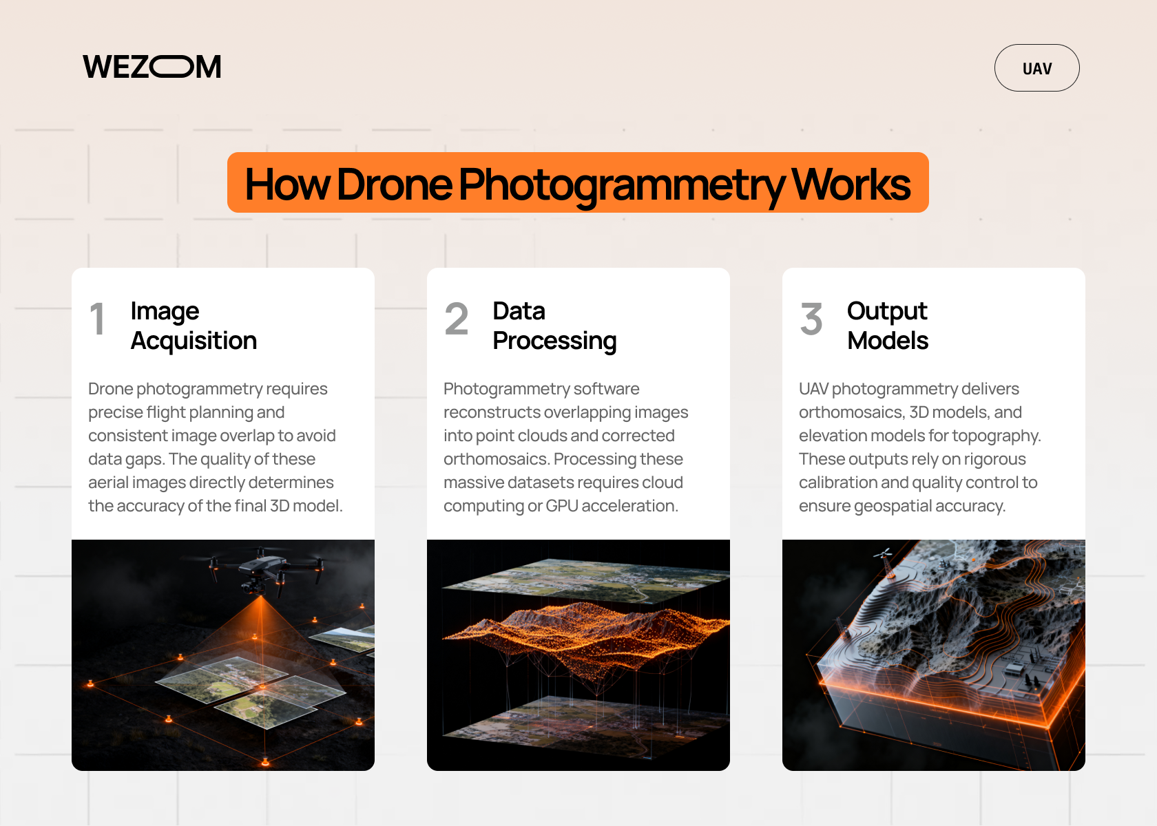
Image Acquisition
Drone photogrammetry begins with aerial image acquisition, where a UAV captures hundreds of overlapping images across a target area. The quality of the final reconstruction depends on flight stability, sensor performance, overlap consistency, and environmental conditions.
Flight planning is a critical stage in photogrammetry with drones. Operators define flight altitude, overlap percentage, camera angle, and waypoint paths before deployment. These parameters influence dataset resolution, processing quality, and mapping accuracy. In enterprise projects, flight planning is often integrated with GIS or surveying data to align aerial imagery with operational goals.
Image overlap is essential for accurate reconstruction. Frontlap refers to the overlap between images captured along the same flight path, while sidelap applies to adjacent flight lines. Insufficient overlap can create reconstruction gaps or inaccurate terrain models, especially in areas with vegetation, repetitive textures, or reflective surfaces. RGB cameras remain the most common sensor type because they provide high-resolution imagery suitable for mapping, modeling, and orthomosaic generation.
Data Processing
After image collection, the dataset is processed with photogrammetry software. The system analyzes overlapping aerial imagery and identifies common reference points between photographs. These points allow the software to estimate camera positions and reconstruct terrain geometry.
The stitching process aligns images into a unified geospatial model and generates sparse and dense point clouds used for reconstruction. One of the most common outputs is an orthomosaic map — a geometrically corrected aerial image that compensates for distortion and perspective differences. Orthomosaics are widely used for surveying, construction monitoring, and geospatial analysis.
Large drone-based photogrammetry projects often require cloud processing or GPU acceleration because high-resolution aerial datasets can involve thousands of images and extensive reconstruction workloads.
Output Models
UAV photogrammetry can generate several output formats depending on project goals. Common deliverables include 2D orthomosaic maps, 3D models, digital elevation models (DEMs), and digital surface models (DSMs). These outputs support mapping, topography, terrain analysis, volumetric calculations, and infrastructure planning.
The operational value of drone photogrammetry depends not only on visualization quality but also on geospatial accuracy and reliable coordinates. For this reason, calibration, validation, and quality control remain important throughout the entire workflow.
UAV Photogrammetry Workflow
Successful drone photogrammetry projects follow a structured workflow that combines aerial image acquisition, geospatial processing, reconstruction, and analysis. Each stage directly affects the quality, accuracy, and reliability of the final dataset. In professional UAV photogrammetry operations, standardized workflows help organizations reduce reconstruction errors, improve measurement consistency, and maintain reliable outputs across recurring drone mapping missions.
Define Project Goals
The first stage of UAV photogrammetry involves defining project objectives and required deliverables. Organizations must determine whether they need orthomosaic maps, 3D models, topography analysis, terrain reconstruction, volumetric calculations, or surveying datasets. Different goals require different flight parameters, overlap settings, and processing methods.
At this stage, teams also establish accuracy requirements and evaluate environmental conditions that may affect aerial imagery quality. Engineering or cadastral projects may require centimeter-level precision supported by RTK positioning and ground control points, while monitoring projects may focus more on speed and repeatability. Site assessment is equally important because vegetation density, reflective surfaces, restricted airspace, and terrain complexity can influence reconstruction quality and operational safety.
Plan the Drone Flight
Flight planning is one of the most critical stages in photogrammetry with drones. Operators configure flight altitude, camera angle, overlap percentage, waypoint paths, and positioning settings according to project requirements. Proper frontlap and sidelap overlap ensure that the processing software can identify matching points between images and generate accurate point clouds and orthomosaics.
Flight altitude directly affects resolution and coverage efficiency. Lower altitude missions provide more detail but increase the number of captured images and processing requirements. Higher altitude improves area coverage but may reduce modeling precision. Weather conditions, lighting consistency, wind speed, and GPS signal quality must also be evaluated before deployment to reduce operational risk and avoid reconstruction artifacts.
Capture Aerial Images
During the mission, drones for photogrammetry follow predefined flight paths while capturing overlapping aerial imagery at consistent intervals. Stable flight behavior and accurate calibration are essential because motion blur, unstable exposure, or inconsistent overlap may negatively affect reconstruction quality.
Operators typically monitor telemetry, battery levels, GPS positioning, and image coverage throughout the mission. In enterprise drone-based photogrammetry workflows, real-time quality checks help identify missing sections or acquisition problems before the flight is completed. Consistent image quality improves reconstruction accuracy and reduces the likelihood of costly repeat missions.
Process Photogrammetry Data
After image acquisition, aerial datasets are uploaded into photogrammetry software for reconstruction and analysis. The system aligns overlapping imagery, estimates camera positions, and generates sparse and dense point clouds representing terrain, structures, and infrastructure.
The processing workflow may also include orthomosaic generation, DEM and DSM modeling, terrain reconstruction, and 3D visualization. Large drone photogrammetry projects often require cloud processing or GPU acceleration because high-resolution aerial datasets generate significant computing workloads. Standardized processing pipelines help organizations improve scalability and maintain consistent geospatial outputs across multiple projects.
Analyze and Export Results
The final stage focuses on validation, measurement, analysis, and data export. Teams verify reconstruction accuracy, coordinate consistency, and dataset quality before using outputs operationally. Common analysis tasks include terrain profiling, topography analysis, volumetric estimation, infrastructure measurement, and change detection between recurring drone surveys.
Final deliverables may include orthomosaic maps, GIS layers, CAD-compatible terrain models, dense point clouds, DEMs, DSMs, or textured 3D assets. Proper export and integration workflows are important because drone mapping datasets are often used within GIS platforms, BIM systems, engineering software, and asset management environments.
Equipment and Software for UAV Photogrammetry
Drones for Photogrammetry
Choosing the right hardware is essential for successful drone photogrammetry operations. Different UAV platforms are designed for different mapping conditions, terrain types, and accuracy requirements. Organizations selecting drones for photogrammetry typically evaluate flight endurance, sensor compatibility, positioning systems, and operational stability.
Multirotor drones are commonly used for localized aerial mapping, construction monitoring, and infrastructure inspection because they provide stable hovering and precise maneuverability. These systems are effective in confined areas or around complex structures, although they usually have shorter flight endurance.
Fixed-wing UAVs are better suited for large-scale drone-based photogrammetry projects where broad coverage and long flight duration are priorities. They are widely used in agriculture, mining, and corridor mapping, but require more space for takeoff and landing.
Sensor selection also affects reconstruction quality. RGB cameras remain the standard choice because they provide high-resolution imagery suitable for orthomosaic generation, 3D modeling, and topography analysis. Some enterprise projects additionally use thermal, multispectral, or LiDAR sensors depending on operational goals.
RTK and PPK positioning systems improve UAV photogrammetry accuracy by increasing GNSS precision during flight operations. These technologies reduce positional uncertainty and support engineering-grade mapping workflows.
Photogrammetry Software
Photogrammetry software converts aerial imagery into geospatial outputs such as orthomosaic maps, point clouds, DEMs, and 3D models. These platforms manage image alignment, calibration, reconstruction, and export workflows.
Modern photogrammetry with drones increasingly relies on AI-assisted automation to accelerate processing and reduce manual tasks. Automated feature recognition, terrain classification, and quality validation help organizations process large aerial datasets more efficiently.
Cloud-based processing is also becoming common in enterprise drone photogrammetry workflows. Instead of relying only on local infrastructure, companies use scalable cloud environments to speed up reconstruction, centralize data management, and improve collaboration between engineering and GIS teams.
Integration with GIS, BIM, digital twin, and asset management systems is another growing trend. These integrations allow drone mapping outputs to support infrastructure planning, maintenance workflows, operational analysis, and long-term monitoring programs.
Key Applications of UAV Photogrammetry
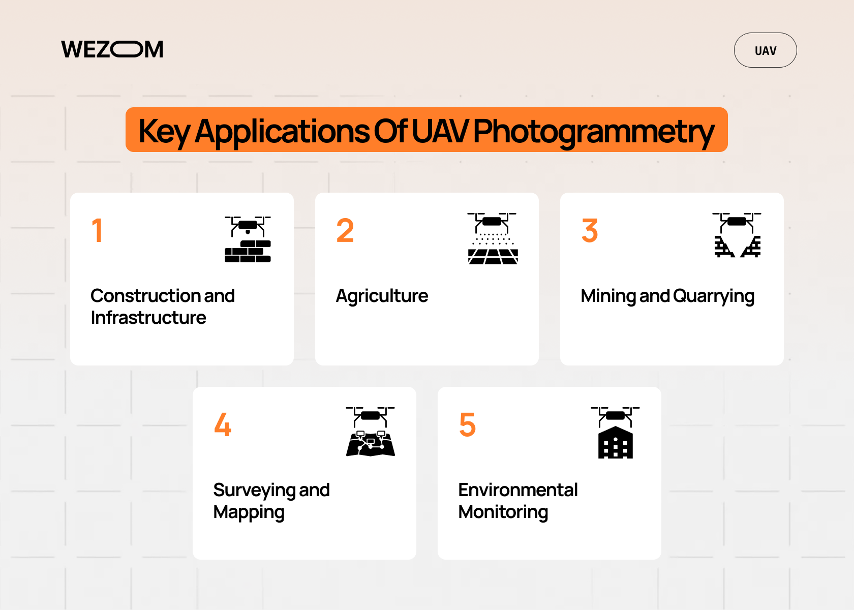
UAV photogrammetry is widely used across industries that require accurate mapping, surveying, monitoring, and geospatial analysis. By combining aerial imagery, reconstruction, and modeling, organizations can collect spatial data faster and more efficiently than with many traditional methods.
Construction and Infrastructure
Construction companies use drone photogrammetry for site monitoring, progress tracking, terrain analysis, and volumetric calculations. Regular aerial surveys help compare actual site conditions with engineering plans using orthomosaics and 3D models. This improves visibility into project timelines, excavation progress, and infrastructure development.
Drone-based photogrammetry is also used for stockpile measurement, drainage analysis, and construction documentation. Repeated UAV missions provide measurable datasets that support BIM integration and operational planning throughout the project lifecycle.
Agriculture
In agriculture, photogrammetry with drones supports field mapping, terrain modeling, and crop monitoring. High-resolution aerial imagery helps identify drainage problems, erosion, irrigation issues, and field inconsistencies. Orthomosaic maps generated through UAV photogrammetry improve operational planning for planting, fertilization, and harvesting activities.
Digital elevation models also help farmers analyze slope patterns and water distribution across large agricultural areas. Frequent drone surveys provide updated datasets for seasonal planning and resource management.
Mining and Quarrying
Mining companies rely on drone photogrammetry for terrain analysis, volumetric calculations, and excavation monitoring. Dense point clouds and terrain models allow operators to estimate stockpile volumes and monitor material movement more efficiently than manual field methods.
UAV photogrammetry also improves safety by reducing the need for personnel to access hazardous areas. In large mining environments, fixed-wing drones for photogrammetry are often used because they provide broader aerial coverage and longer flight endurance.
Surveying and Mapping
Surveying remains one of the core applications of drone-based photogrammetry. UAV workflows generate orthomosaics, contour maps, and elevation datasets used for land surveying, topography analysis, and infrastructure planning.
Large-scale mapping projects benefit from faster aerial coverage and improved operational efficiency, especially in remote or difficult terrain. However, some engineering and cadastral applications still require traditional surveying methods for maximum precision.
Environmental Monitoring
Environmental organizations use UAV photogrammetry for forestry analysis, ecosystem monitoring, and disaster assessment. Orthomosaic imagery and terrain models help analyze vegetation coverage, storm damage, and terrain changes over time.
Following floods, landslides, or fires, drones can rapidly capture aerial imagery from affected areas without exposing teams to unsafe conditions. In many projects, drone mapping is combined with thermal imaging or LiDAR to improve environmental analysis and terrain visibility.
Factors That Affect Drone Photogrammetry Accuracy
The accuracy of drone photogrammetry depends on image quality, positioning precision, environmental conditions, and processing consistency. Even modern UAV photogrammetry systems can produce unreliable outputs if critical operational factors are not properly managed.
- Image Overlap
Frontlap and sidelap determine how much overlap exists between aerial images. Proper overlap helps reconstruction software identify matching points and generate accurate point clouds, orthomosaics, and terrain models. Insufficient overlap may create gaps or distorted outputs. - Ground Control Points (GCPs)
GCPs improve coordinate accuracy by aligning aerial datasets with real-world geospatial positions. They are especially important in drone-based photogrammetry projects requiring engineering-grade measurements or large-scale mapping precision. - Weather Conditions
Wind, rain, fog, and inconsistent lighting can reduce image sharpness and affect reconstruction quality. Shadows and reflective surfaces may also interfere with feature detection during photogrammetry with drones. - Camera Calibration
Proper calibration reduces lens distortion and geometric inaccuracies. Stable exposure settings, sensor consistency, and correct camera alignment improve dataset reliability and reconstruction accuracy. - RTK and PPK Positioning
RTK and PPK technologies enhance GNSS precision during UAV flights. These systems reduce positional uncertainty and improve the accuracy of drone photogrammetry workflows, especially in surveying, construction, and infrastructure projects.
When Businesses Should Use Professional UAV Photogrammetry Services
Although modern drones and automated software have made aerial mapping more accessible, many commercial projects still require professional UAV photogrammetry services. Large-scale drone photogrammetry operations often involve complex flight planning, geospatial validation, regulatory compliance, and advanced data processing workflows.
Professional support is especially important for:
- Large-scale mapping — infrastructure corridors, mining sites, industrial facilities, and agricultural regions require reliable aerial coverage and scalable processing.
- Engineering-grade accuracy — construction, surveying, and terrain analysis projects may require RTK positioning, calibrated sensors, and strict quality control procedures.
- Recurring inspections — long-term monitoring programs depend on consistent flight altitude, overlap, and processing standards for reliable comparison over time.
- Complex terrain — dense vegetation, steep topography, urban environments, and restricted airspace can significantly affect drone-based photogrammetry performance.
- GIS and CAD integration — enterprise projects often require outputs compatible with BIM, GIS, CAD, or digital twin systems.
Professional UAV photogrammetry providers typically use standardized workflows for mapping, reconstruction, analysis, and data export. This helps organizations reduce operational risk while improving dataset accuracy, scalability, and interoperability across engineering and geospatial systems.
Benefits of Drone Photogrammetry
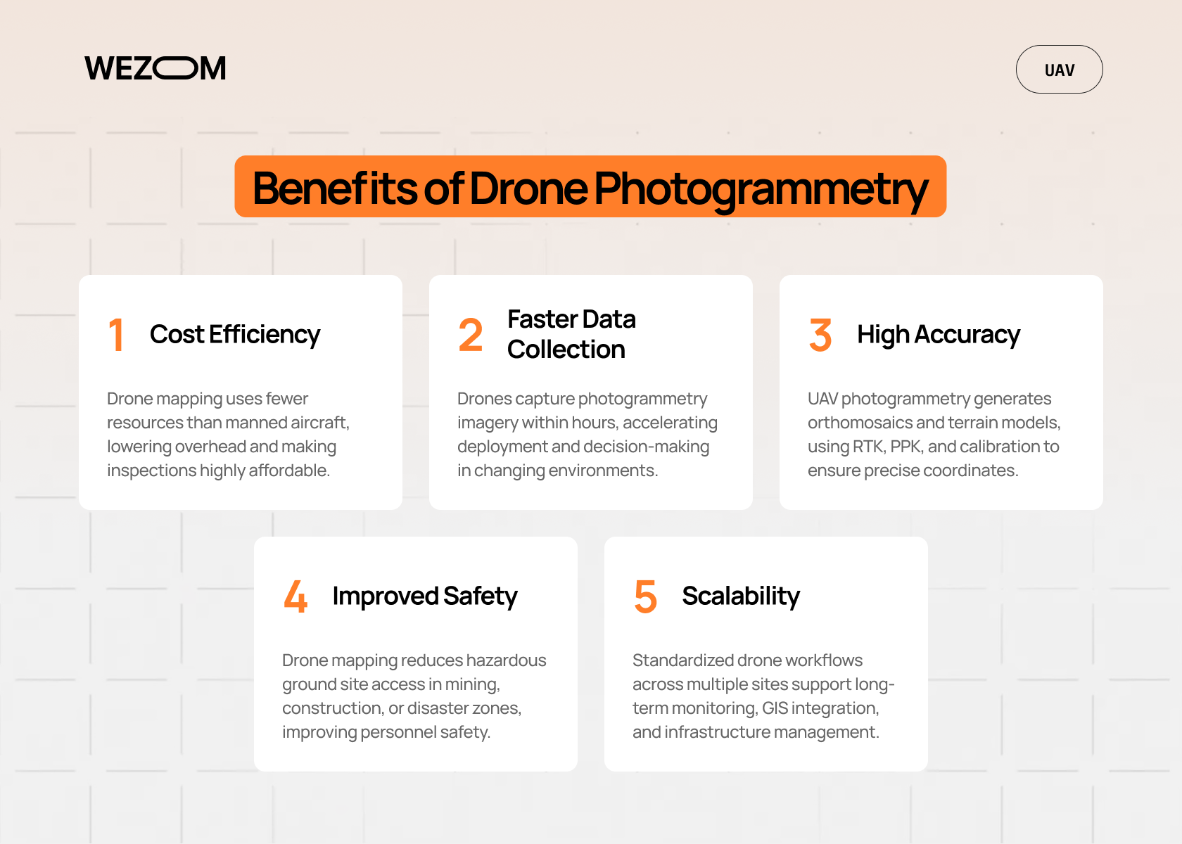
Drone photogrammetry helps organizations collect accurate geospatial data faster and more efficiently than many traditional surveying methods. Businesses use UAV photogrammetry in construction, agriculture, mining, infrastructure, and environmental monitoring because it combines speed, scalability, and high-resolution aerial analysis.
Key benefits of drone-based photogrammetry include:
- Cost Efficiency
Compared to traditional aerial surveying with manned aircraft, drone mapping usually requires smaller teams, less equipment, and lower operational overhead. This makes recurring inspections and monitoring projects more affordable. - Faster Data Collection
Drones for photogrammetry can capture aerial imagery within hours instead of days or weeks. Faster deployment improves operational visibility and supports quicker decision-making in rapidly changing environments. - High Accuracy
Modern UAV photogrammetry workflows generate detailed orthomosaics, terrain models, and measurement datasets. RTK, PPK, and proper calibration improve coordinate precision for engineering and surveying applications. - Improved Safety
Photogrammetry with drones reduces the need for personnel to access hazardous environments such as mining sites, unstable terrain, construction zones, or disaster areas. - Scalability
Organizations can standardize recurring drone photogrammetry workflows across multiple sites and projects. This supports long-term monitoring, GIS integration, predictive analysis, and infrastructure management.
Although UAV photogrammetry offers major operational advantages, successful implementation still depends on proper flight planning, data processing, and quality control procedures.
Challenges and Limitations
Although drone photogrammetry offers major advantages for mapping, surveying, and analysis, organizations must also consider its operational limitations. Successful UAV photogrammetry projects require proper flight planning, processing infrastructure, and quality control to avoid inaccurate datasets or reconstruction errors.
Key challenges of drone-based photogrammetry include:
- Weather Dependency
Wind, rain, fog, shadows, and unstable lighting conditions can reduce image quality and affect reconstruction accuracy. Strong wind may also create motion blur or inconsistent image overlap. - Processing Requirements
High-resolution aerial imagery generates large datasets that require significant computing power, storage capacity, and processing time. Enterprise drone photogrammetry workflows often rely on cloud processing or GPU acceleration. - Regulatory Restrictions
Drone mapping operations must comply with airspace regulations, flight permissions, privacy laws, and certification requirements. Restrictions are especially important near airports, urban areas, or critical infrastructure. - Environmental Complexity
Photogrammetry with drones may struggle in areas with dense vegetation, reflective surfaces, low texture, or poor lighting. These conditions can reduce reconstruction reliability and create incomplete models. - LiDAR Limitations
Compared to LiDAR, UAV photogrammetry is less effective in penetrating dense vegetation or capturing terrain beneath tree cover. Some projects may require hybrid drone mapping approaches combining LiDAR and photogrammetry. - Data Management
Large drone photogrammetry projects can generate terabytes of imagery, point clouds, and geospatial data. Without standardized storage and workflow management, maintaining long-term dataset consistency becomes difficult.
UAV Photogrammetry vs Traditional Surveying
UAV photogrammetry and traditional surveying are not direct replacements for one another. Instead, they represent different approaches with unique strengths, limitations, and operational use cases. Many organizations achieve the best results by combining both methods within broader geospatial workflows.
Drone photogrammetry is often more cost-effective for large-area mapping, recurring inspections, and construction monitoring because it reduces field labor and enables rapid aerial data collection. UAV workflows can survey large territories within hours, improving operational visibility and allowing more frequent updates across mining, agriculture, infrastructure, and construction projects.
However, lower operational cost does not always mean higher precision. Traditional surveying remains important for projects involving legal boundaries, cadastral work, or engineering tasks that require extremely strict measurement tolerances. Modern UAV photogrammetry systems with RTK, PPK, and calibrated sensors can provide highly accurate outputs, but some applications still require direct ground-based measurements.
Another major advantage of drone-based photogrammetry is accessibility. UAVs can safely collect aerial imagery in hazardous or difficult environments where manual surveying would be slower or riskier, including industrial zones, unstable terrain, and disaster areas.
The choice between UAV photogrammetry and traditional surveying depends on factors such as required accuracy, terrain complexity, survey area size, regulatory requirements, and integration with engineering workflows. In practice, many companies use drone mapping as a complementary technology alongside conventional surveying methods.
| Factor | UAV Photogrammetry | Traditional Surveying |
|---|---|---|
| Data Collection | Aerial imagery captured by drones | Ground-based measurements |
| Coverage Speed | Fast large-area mapping | Slower for large territories |
| Operational Cost | Lower for recurring surveys | Higher labor and field costs |
| Accuracy | High with RTK/PPK and GCPs | Extremely high precision |
| Terrain Accessibility | Effective in hazardous or remote areas | Requires direct site access |
| Main Outputs | Orthomosaics, 3D models, DEMs, point clouds | Coordinate measurements, boundary data |
| Best Use Cases | Mapping, monitoring, volumetric analysis | Engineering, cadastral, and legal surveys |
| Processing Requirements | Requires reconstruction software and computing power | Lower processing complexity |
| Safety | Reduced field exposure | Higher field involvement |
Future Trends in UAV Photogrammetry
UAV photogrammetry continues to evolve as AI, automation, cloud computing, and advanced sensor technologies reshape aerial mapping workflows. Businesses increasingly use drone photogrammetry not only for standalone mapping missions but also as part of broader geospatial and digital transformation strategies.
One of the biggest trends is AI-driven automation. Modern photogrammetry software can automate image alignment, terrain classification, reconstruction, and quality control, reducing manual processing time and improving scalability for enterprise drone mapping operations.
Real-time and near-real-time mapping is also becoming more common. Advances in onboard computing, cloud processing, and wireless connectivity allow organizations to generate aerial visualization and analysis faster, which is especially valuable for inspections, infrastructure monitoring, and emergency response.
Integration with GIS platforms, BIM systems, and digital twin environments is another growing trend in UAV photogrammetry. Businesses increasingly combine aerial imagery with operational, engineering, and asset management data to improve planning and long-term infrastructure analysis.
At the same time, hybrid workflows that combine photogrammetry with LiDAR, thermal imaging, and multispectral sensors are becoming more popular for complex terrain analysis and advanced environmental monitoring. As automation and drone hardware continue to improve, UAV photogrammetry is expected to become a standard tool in large-scale mapping and geospatial analysis workflows.
Conclusion
UAV photogrammetry has become an important technology for mapping, surveying, and geospatial analysis across multiple industries. By combining aerial imagery, reconstruction processing, and accurate coordinates, organizations can generate detailed terrain models, orthomosaics, and 3D visualizations faster than many traditional methods.
Successful drone photogrammetry projects depend on proper flight planning, overlap configuration, calibration, and processing workflows. As AI automation and geospatial integration continue to evolve, UAV photogrammetry will play an even larger role in digital infrastructure and operational analysis.

FAQ
Is drone photogrammetry expensive?
The cost depends on project scale, required accuracy, terrain complexity, and processing requirements. Small drone mapping projects may be relatively affordable, while engineering-grade surveys require more advanced infrastructure and quality control.
How accurate is drone photogrammetry?
Drone photogrammetry can achieve high accuracy when supported by proper overlap, calibration, RTK positioning, and ground control points. Accuracy requirements vary by industry and project type.
What software is used for photogrammetry with drones?
Photogrammetry with drones uses software designed for image stitching, point cloud generation, orthomosaic processing, and 3D reconstruction. Enterprise platforms often support cloud processing and GIS integration.
Can drones replace traditional surveying?
Drones cannot fully replace traditional surveying in all cases. UAV photogrammetry is highly effective for large-scale mapping and monitoring, but some engineering and legal measurements still require ground-based methods.
How long does drone photogrammetry take?
Flight operations may take only a few hours, but processing large aerial datasets can require additional time depending on project complexity, resolution, and computing infrastructure.
