


1. Discovery & Data Audit
Wezom analyzed RGB, thermal, and multispectral imagery from drone flights, validated metadata quality, and created AI training benchmarks.
Over 50,000 images were annotated using CVAT, categorized by crop type, vegetation condition, and visible stress markers.
Collaboration with agronomists helped align visual labels (e.g., leaf discoloration or density anomalies) with real field conditions like drought or disease.
2. AI Experimentation Cycle
The team developed and tested models using both convolutional and transformer-based architectures (RT-DETRv2) for detection tasks.
For yield forecasting, XGBoost regression models were applied on aggregated NDVI/NDRE data and soil metrics.
Model performance was evaluated through Precision, Recall, F1, and ROC-AUC to ensure robustness and low false-negative rates critical for agronomic applications.
3. Architecture Design
Wezom built a modular data pipeline separating ingestion, preprocessing, analytics, and visualization layers.
The backend was implemented with FastAPI, Celery, and PostgreSQL/PostGIS for scalable geospatial processing, with imagery and model versions stored in AWS S3.
4. Integration Phase
The system was integrated with the client’s ERP and GIS platforms using REST APIs, GeoTIFF, and SHP exports, allowing seamless data exchange and automated reporting.
5. Continuous Improvement
Custom monitoring scripts track data quality, model drift, and inference performance.
A retraining pipeline ensures models remain accurate as new drone imagery and seasonal data are added.
AI & Data Science Layer
- TensorFlow, Scikit-learn, OpenCV
- RT-DETRv2 for anomaly detection
- XGBoost for yield forecasting
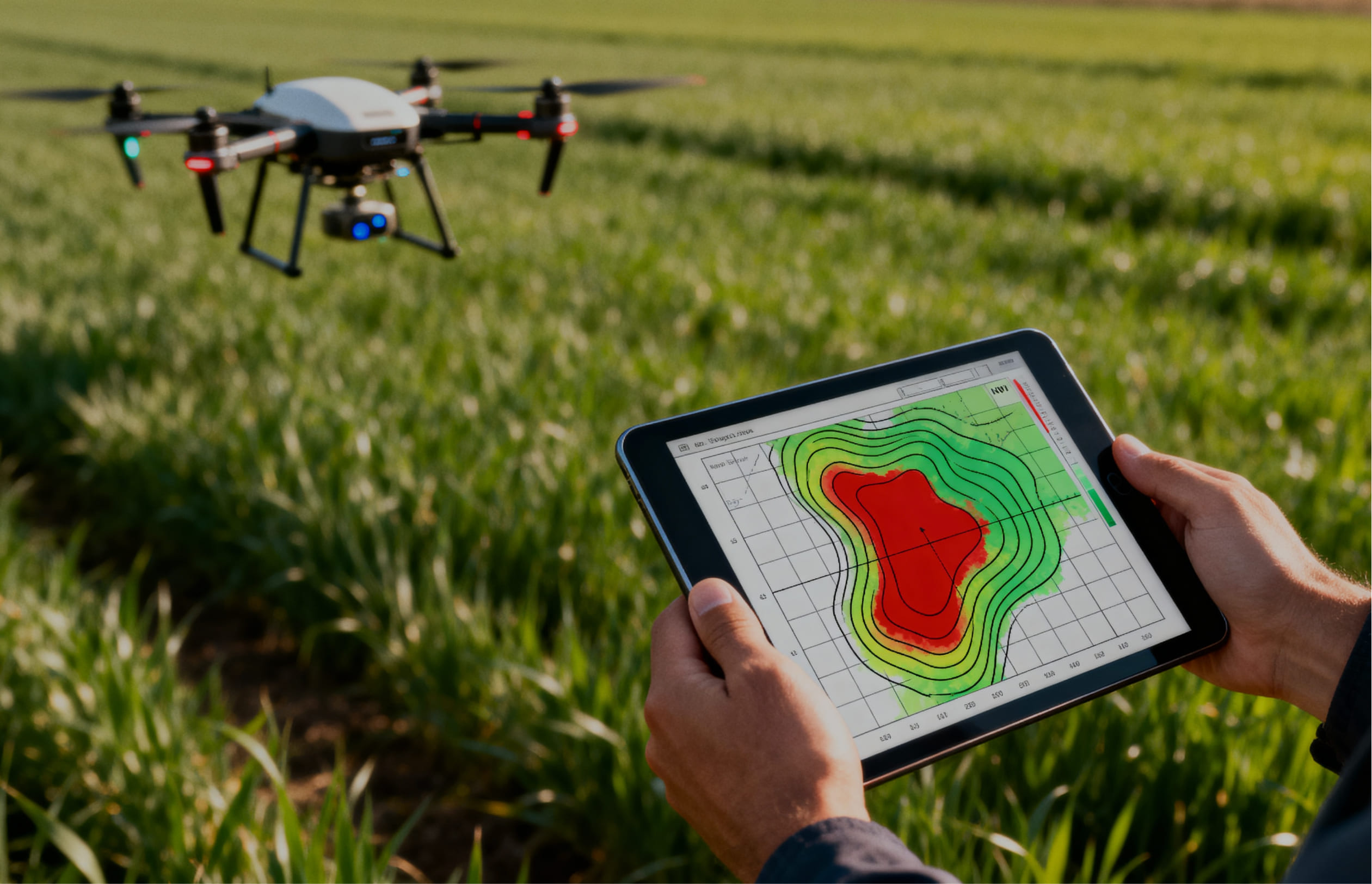
- NDVI/NDRE computation from multispectral data
- CVAT & DVC for annotation and dataset version control
Backend & Infrastructure
- FastAPI microservices
- Celery distributed task queue
- PostgreSQL + PostGIS
- AWS S3 storage and model registry
- Dockerized environment with GitLab CI/CD
Frontend & Visualization
- React + D3.js + Mapbox GL
- Role-based dashboards for agronomists, data scientists, and managers
- Interactive vegetation maps and yield forecasting panels
Integrations
- ERP (REST / JSON)
- GIS (GeoTIFF, SHP, WMS/WFS)
- OAuth2 / SSO authentication
Wezom delivered an end-to-end AI pipeline capable of processing up to 8,000 aerial images per flight session in just a few hours.
Field testing on multiple crop types showed F1 = 0.78 ± 0.02 and PR-AUC = 0.84 for vegetation stress detection, ensuring consistent and reliable anomaly identification.
Yield regression models achieved prediction accuracy with MAE < 8% across different regions.
The inference speed reached 10 frames per second, enabling near real-time analytics on high-volume datasets.
The system processed over 2 TB of aerial imagery without performance degradation and supported linear scalability via GPU clustering.
Thanks to transfer learning, retraining models for new regions required fewer than 500 additional labeled samples, reducing adaptation time by over 70%.
Integrated with ERP and GIS tools, FieldSense became the client’s central precision agriculture software solution — connecting aerial data with operational outcomes, enabling faster field interventions, and delivering measurable ROI through data-driven crop monitoring and UAV analytics.
