
LiDAR technology has become one of the most important innovations in modern UAV mapping systems, enabling organizations to collect highly accurate three-dimensional spatial data faster and more efficiently than many traditional surveying methods. From infrastructure development and environmental monitoring to mining operations and precision agriculture, drone-based LiDAR solutions are transforming how terrain, assets, and landscapes are analyzed.
However, the success of a LiDAR mission depends on much more than the sensor itself. Achieving reliable results requires a carefully designed custom LiDAR drone payload, accurate drone LiDAR integration, synchronized navigation systems, and a well-structured drone LiDAR data pipeline capable of transforming raw measurements into actionable geospatial intelligence. As mapping projects become more complex, organizations are increasingly adopting advanced technologies such as RTK GNSS integration, sensor fusion, and LiDAR SLAM drone navigation to improve accuracy, autonomy, and operational reliability.
At the same time, modern aerial LiDAR scanning workflows must balance payload constraints, flight efficiency, processing requirements, and data quality objectives. Understanding how LiDAR sensors interact with IMUs, cameras, radar systems, and onboard computing infrastructure is essential for building scalable mapping solutions.
This article explores the complete LiDAR ecosystem for UAV platforms, including payload architecture, integration workflows, point cloud processing, sensor fusion strategies, SLAM-based navigation, and real-world applications across surveying, infrastructure, forestry, mining, and environmental monitoring.
Drone LiDAR Payload Architecture
Modern UAV mapping systems rely on far more than a LiDAR sensor attached to a drone. Successful aerial LiDAR scanning projects require a carefully engineered payload architecture that balances performance, weight, power consumption, flight endurance, and data quality. Whether the goal is infrastructure inspection, environmental monitoring, or drone topographic survey LiDAR operations, the payload serves as the foundation of the entire mapping workflow.
Different types of LiDAR sensors are used depending on mission requirements. Some projects prioritize lightweight designs and longer flight times, while others require maximum range, higher point density, and industrial-grade reliability.
The most common LiDAR categories used in UAV platforms include:
- Mechanical LiDAR systems;
- Solid-state LiDAR systems;
- Hybrid LiDAR architectures;
- Multi-return LiDAR sensors for vegetation penetration;
- Long-range industrial mapping sensors.
The distinction between compact and industrial payloads goes beyond sensor size. Compact payloads are designed for smaller UAV platforms and localized mapping missions. Industrial payloads typically incorporate additional computing resources, advanced GNSS receivers, larger storage capacity, and enhanced stabilization systems.
A typical custom LiDAR drone payload often includes:
- LiDAR sensor;
- RTK GNSS integration module;
- Inertial measurement unit (IMU);
- Onboard computer;
- Data storage device;
- Power management subsystem;
- Communication equipment.
Power and weight remain the primary constraints in payload design. Every additional component affects flight endurance, payload capacity, and operational coverage. Engineers must carefully balance performance requirements against practical flight limitations.
Manufacturers such as Hesai have become important contributors to the UAV ecosystem. A Hesai LiDAR drone configuration is commonly selected for applications requiring a balance between scanning range, point density, and payload efficiency. However, sensor selection should always be aligned with the overall mission profile rather than based solely on specifications.
Ultimately, UAV mapping systems succeed when all payload components operate as a coordinated sensing platform rather than as individual devices. The architecture determines not only data quality but also scalability, reliability, and long-term operational efficiency.
Drone LiDAR Integration Workflow
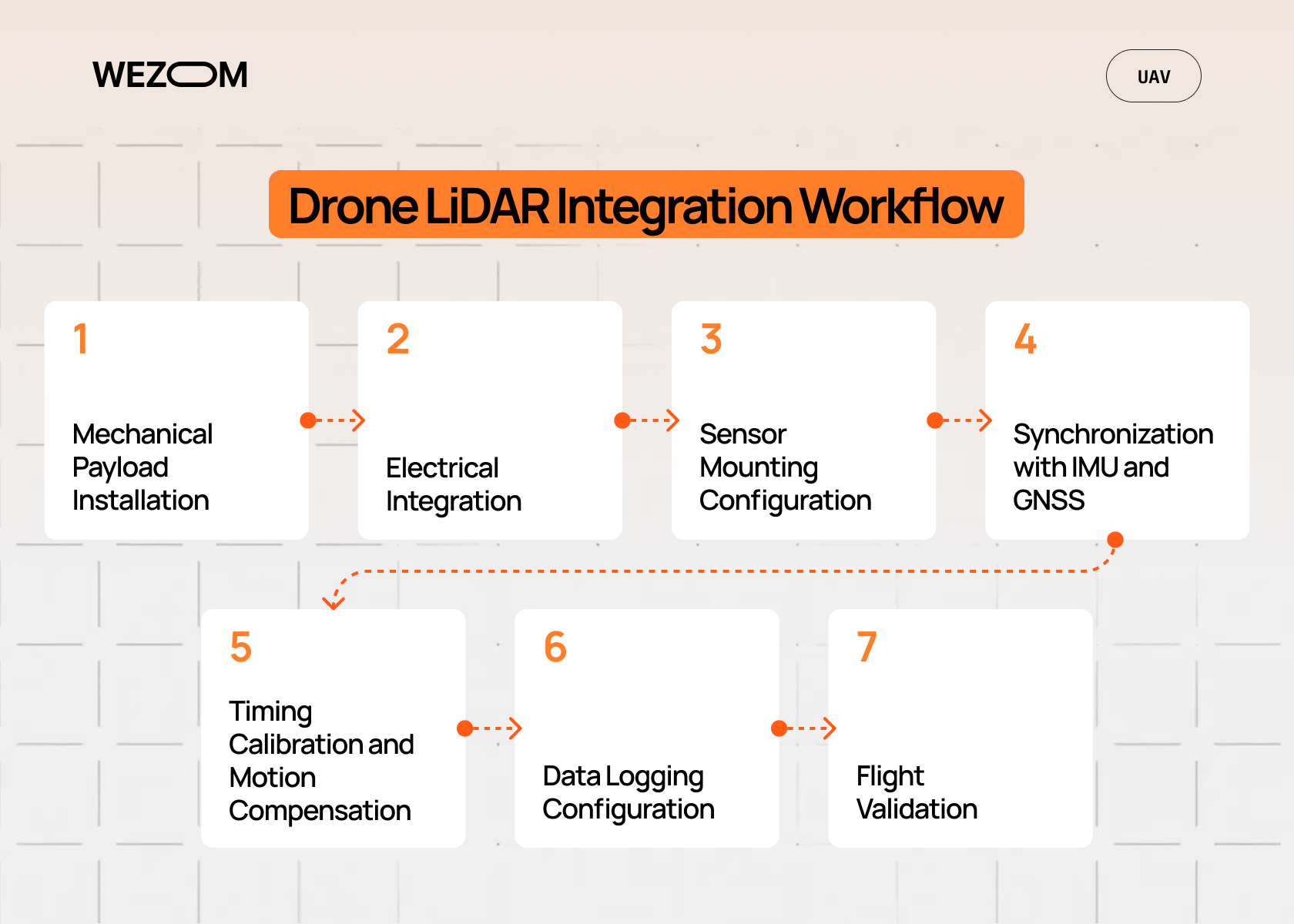
Drone LiDAR integration involves much more than mounting a sensor onto an aircraft. It requires synchronization between hardware, software, navigation systems, and onboard processing infrastructure. Small integration mistakes can create significant errors in geospatial outputs, even when high-end sensors are used.
Most drone LiDAR integration projects follow a structured workflow.
Typical Integration Process
- Mechanical Payload Installation
The LiDAR unit is mounted on the UAV platform while maintaining proper center-of-gravity balance and minimizing vibration exposure. Poor mounting can negatively affect both flight stability and point cloud quality. - Electrical Integration
Power distribution and communication interfaces are connected between the LiDAR, flight controller, onboard computer, and storage systems. Reliable connectivity is essential for uninterrupted operation. - Sensor Mounting Configuration
Teams choose between fixed-frame and gimbal-based installations. Fixed mounts reduce complexity, while gimbals can improve stabilization during dynamic flight conditions. - Synchronization with IMU and GNSS
The LiDAR sensor must operate within the same timing framework as the inertial measurement unit (IMU) and GNSS systems. This synchronization forms the basis for accurate trajectory reconstruction. - Timing Calibration and Motion Compensation
Engineers perform calibration procedures to eliminate timing offsets and apply motion compensation algorithms that correct distortions caused by aircraft movement. - Data Logging Configuration
Storage systems are configured to record LiDAR measurements, navigation data, timestamps, telemetry, and additional sensor outputs without introducing bottlenecks. - Flight Validation
Test missions verify sensor alignment, calibration accuracy, synchronization quality, and overall system performance before operational deployment.
A properly integrated system ensures that all data sources contribute to a single coherent mapping dataset. This significantly improves georeferencing accuracy and reduces downstream processing issues.
Drone LiDAR Data Pipeline
Collecting point clouds is only the beginning of a mapping project. The real value emerges through the drone LiDAR data pipeline that transforms raw sensor measurements into structured geospatial datasets suitable for analysis and decision-making.
Every flight generates millions of measurements. Without a properly designed pipeline, organizations quickly encounter storage challenges, processing bottlenecks, and data quality issues.
A typical drone LiDAR data pipeline includes the following stages:
- Raw point cloud acquisition.
- Data transfer to the ground station or cloud environment.
- Noise filtering.
- Point cloud alignment.
- Georeferencing.
- Coordinate transformation.
- Export and storage.
The acquisition stage captures spatial measurements as laser pulses interact with terrain and objects. These raw datasets contain valuable information but also include noise, duplicate points, and environmental artifacts.
Once the mission is complete, the data is transferred to the processing infrastructure. Many organizations now utilize cloud-based geospatial data processing environments to accelerate workflows and support large-scale mapping projects.
During pre-processing, engineers perform:
- Noise filtering;
- Outlier removal;
- Point cloud alignment;
- Dataset merging;
- Quality validation.
Georeferencing is one of the most critical stages of the pipeline. By combining RTK positioning, trajectory estimation, and calibration parameters, every point receives accurate geographic coordinates. This directly influences georeferencing accuracy and determines the quality of all downstream deliverables.
The most common storage formats include:
- LAS;
- LAZ;
- PLY.
These formats support efficient point cloud processing while maintaining compatibility with GIS, surveying, and analytics platforms.
Organizations that optimize their drone LiDAR data pipeline typically achieve faster turnaround times, lower processing costs, and more consistent mapping outputs.
Drone 3D Mapping LiDAR Processing
After acquisition and preprocessing, the next objective is to convert point clouds into meaningful mapping products. This is where drone 3D mapping LiDAR systems demonstrate their value compared with traditional surveying and photogrammetry workflows.
The processing workflow usually consists of several interconnected stages:
- Terrain extraction;
- Surface reconstruction;
- DEM generation;
- Orthomosaic integration;
- Feature classification;
- Accuracy validation.
Terrain reconstruction converts discrete point measurements into continuous digital surfaces. Advanced interpolation techniques fill gaps between points and generate highly detailed representations of the landscape.
Digital Elevation Models (DEMs) are among the most common outputs generated from aerial LiDAR scanning projects. DEMs remove vegetation and structures from the dataset to reveal the underlying terrain.
Organizations frequently combine LiDAR outputs with orthomosaic imagery. This integration provides both elevation information and visual context, creating richer datasets for engineering, planning, and environmental analysis.
Point cloud classification enables automatic identification of:
- Ground surfaces;
- Vegetation;
- Buildings;
- Utility infrastructure;
- Vehicles;
- Water bodies.
Accuracy benchmarking is essential before final deliverables are released. Survey teams compare results against ground control points and independent measurements to validate system performance.
As drone 3D mapping LiDAR technology continues to mature, organizations gain access to increasingly detailed terrain models while reducing survey time and operational costs.
Sensor Fusion for UAV Mapping
Modern UAV platforms rarely rely on a single sensor. Instead, they combine multiple sensing technologies to improve accuracy, reliability, and environmental awareness.
Sensor fusion allows individual sensors to compensate for each other's limitations. The result is a more robust mapping system capable of operating in diverse environments.
The following table illustrates the role of each sensor within a typical UAV mapping platform.
| Sensor | Primary Function |
|---|---|
| LiDAR | Geometry capture and distance measurement |
| Camera | Visual context and imagery |
| IMU | Orientation and movement tracking |
| GNSS | Global positioning |
| Radar | Performance in low-visibility conditions |
A typical drone sensor fusion LiDAR radar architecture combines data from all these sources to create a unified environmental model.
This approach offers several advantages:
- Improved positioning accuracy;
- Greater environmental awareness;
- Better navigation reliability;
- Increased redundancy;
- Enhanced resilience to sensor failures.
Radar becomes particularly valuable during fog, dust, smoke, or heavy precipitation, where optical systems may struggle. By integrating radar alongside LiDAR, organizations can maintain operational continuity in more challenging conditions.
The primary challenge lies in synchronization. Each sensor operates at different frequencies and generates different types of data. Precise timing calibration is therefore essential for successful sensor fusion.
LiDAR SLAM for Drone Navigation
The growing adoption of autonomous UAV operations has increased interest in LiDAR-based simultaneous localization and mapping technologies.
A LiDAR SLAM drone continuously builds a map of its environment while simultaneously estimating its own position within that map. Unlike traditional navigation systems that rely heavily on GNSS, SLAM navigation uses environmental features to determine location.
A typical SLAM workflow includes:
- Environment scanning.
- Feature extraction.
- Localization.
- Map generation.
- Loop closure.
- Drift correction.
This approach becomes especially valuable in GPS-denied environments such as:
- Warehouses;
- Industrial facilities;
- Tunnels;
- Forested areas;
- Underground infrastructure.
One of the most important SLAM mechanisms is loop closure. When the drone revisits a previously mapped location, the system recognizes familiar features and corrects accumulated positioning errors.
As autonomous mapping drone technologies continue to evolve, LiDAR SLAM is becoming a critical component of advanced navigation architectures.
Topographic Survey Use Cases
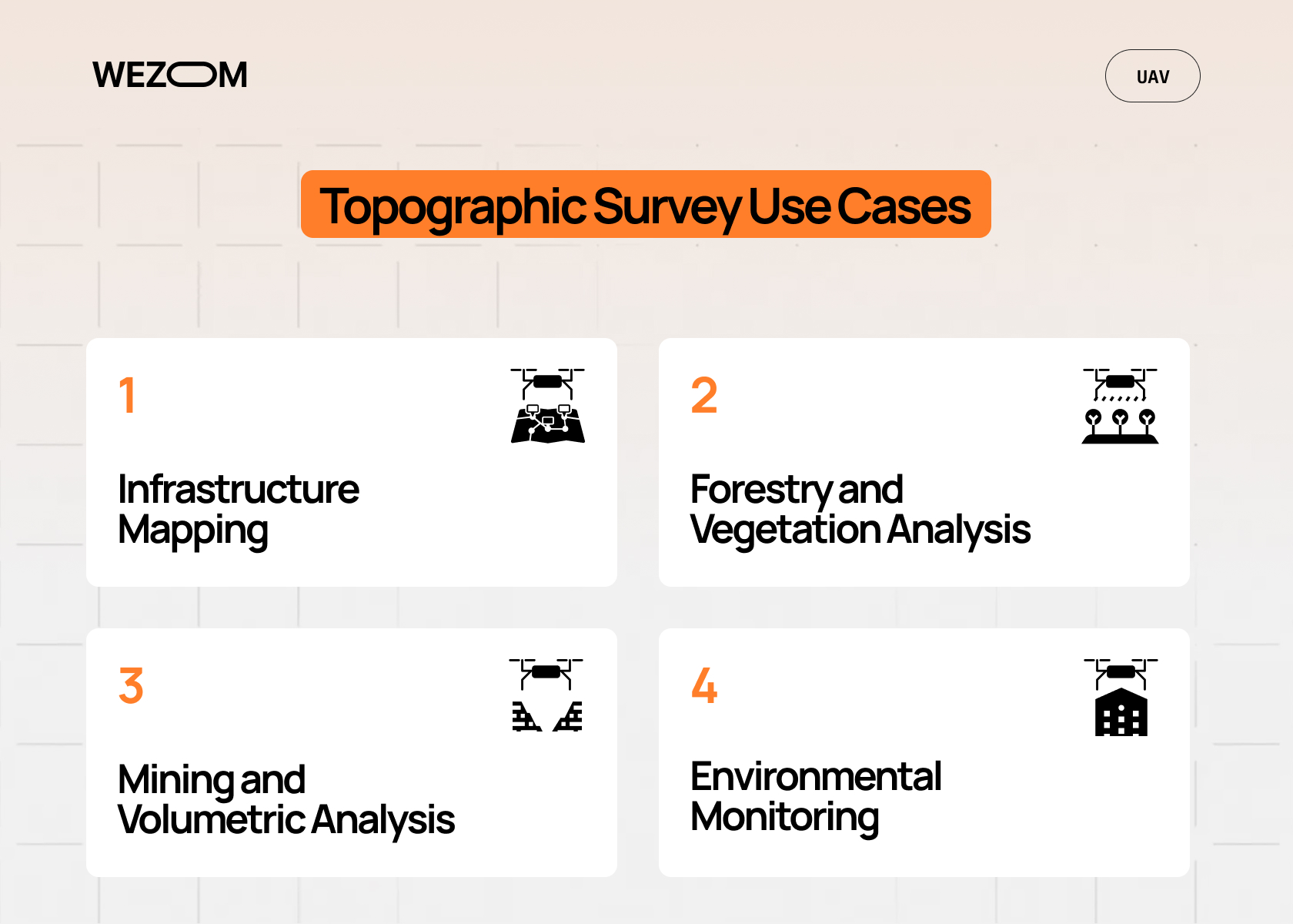
Drone topographic survey LiDAR workflows support a wide range of commercial and industrial applications. The ability to generate highly detailed terrain information quickly has transformed many traditional surveying processes.
Infrastructure Mapping
Road networks, railways, pipelines, and construction projects require accurate terrain data throughout their lifecycle. LiDAR enables rapid corridor mapping and supports engineering design, maintenance planning, and progress monitoring.
Forestry and Vegetation Analysis
Forestry organizations use LiDAR to evaluate canopy height, biomass distribution, vegetation density, and terrain conditions beneath forest cover. This capability provides insights that traditional imagery often cannot deliver.
Mining and Volumetric Analysis
Mining operations frequently utilize UAV mapping systems for stockpile measurements, excavation monitoring, and volumetric calculations. Regular surveys improve operational visibility and planning accuracy.
Environmental Monitoring
Environmental agencies and research organizations use LiDAR for flood modeling, erosion assessment, watershed analysis, habitat monitoring, and climate-related studies.
These use cases demonstrate why UAV mapping systems have become essential tools across numerous industries.
Data Accuracy, Limitations, and Optimization
Even the most advanced LiDAR systems are influenced by environmental and operational conditions. Understanding these factors is essential for maintaining data quality.
Key factors affecting LiDAR accuracy include:
- Weather conditions;
- Flight altitude;
- Aircraft velocity;
- Sensor calibration;
- GNSS signal quality;
- Terrain complexity;
- Vegetation density.
Higher altitudes increase coverage area but reduce point density. Faster flight speeds improve productivity but can introduce motion-related challenges.
To improve accuracy, organizations commonly apply the following optimization strategies:
- RTK correction workflows;
- Boresight calibration;
- Flight overlap planning;
- Trajectory optimization;
- Automated error correction;
- Quality control validation.
A persistent trade-off exists between resolution and efficiency. Higher-resolution datasets require additional flight time, storage resources, and processing capacity. Successful projects balance these competing requirements according to business objectives.
Industry Applications and Deployment Models
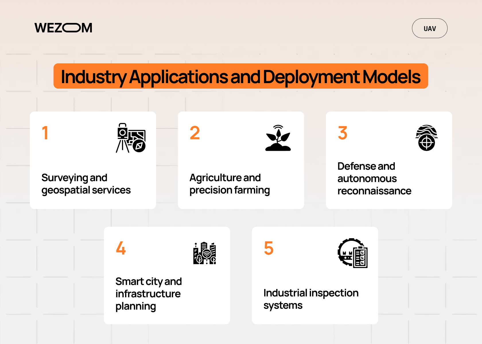
As LiDAR technology becomes more accessible and UAV platforms continue to evolve, organizations across numerous industries are integrating drone-based mapping solutions into their operational workflows. The combination of aerial LiDAR scanning, advanced geospatial data processing, and autonomous navigation capabilities allows businesses to collect accurate spatial information faster than many traditional surveying approaches.
The value of UAV mapping systems extends beyond data collection. Modern deployments support infrastructure planning, asset management, environmental analysis, predictive maintenance, and operational decision-making. Depending on project requirements, organizations may operate their own drone programs, partner with specialized surveying providers, or adopt hybrid deployment models that combine internal expertise with external geospatial services.
Some of the most common industry applications include:
- Surveying and geospatial services – Surveying firms use drone topographic survey LiDAR solutions to generate terrain models, contour maps, engineering surveys, and digital elevation models with high levels of accuracy and efficiency.
- Agriculture and precision farming – Farmers and agribusinesses leverage LiDAR-generated terrain data to improve irrigation planning, drainage analysis, field leveling, and resource optimization across large agricultural areas.
- Defense and autonomous reconnaissance – Defense organizations utilize autonomous mapping drone platforms for terrain intelligence, route planning, situational awareness, and operations in environments where conventional navigation infrastructure may be limited.
- Smart city and infrastructure planning – Municipalities and engineering firms use UAV mapping systems to support transportation planning, utility management, digital twin creation, and long-term urban development initiatives.
- Industrial inspection systems – Energy, utilities, construction, and manufacturing organizations deploy LiDAR-equipped UAVs to inspect critical assets, monitor infrastructure conditions, and identify potential maintenance issues before they become operational risks.
As sensor technology, SLAM navigation, and cloud-based processing continue to advance, the range of LiDAR deployment models is expected to expand further. Organizations that successfully integrate mapping workflows into their operations gain access to faster data collection cycles, more accurate spatial intelligence, and improved decision-making capabilities across complex environments.
Conclusion
Drone LiDAR integration involves far more than selecting a sensor and mounting it onto a UAV. Successful deployments require careful coordination between payload architecture, navigation systems, synchronization mechanisms, and processing workflows.
From custom LiDAR drone payload design to drone LiDAR data pipeline optimization and advanced drone sensor fusion LiDAR radar architectures, every stage contributes to the final mapping quality. Organizations that approach LiDAR as a complete ecosystem rather than a standalone sensor are better positioned to achieve accurate, scalable, and commercially sustainable UAV mapping operations.

FAQ
How does drone LiDAR integration work in UAV systems?
Drone LiDAR integration combines mechanical mounting, electrical connectivity, timing synchronization, calibration, and software processing into a single workflow. The LiDAR sensor works together with IMU and GNSS systems to capture spatial data while maintaining accurate positioning references. Proper integration is essential for achieving reliable mapping results and minimizing downstream processing errors.
What is a custom LiDAR drone payload used for?
A custom LiDAR drone payload is designed for specific operational requirements such as corridor mapping, topographic surveying, infrastructure inspection, forestry analysis, mining operations, or autonomous navigation. Customization allows organizations to optimize payload weight, power consumption, onboard processing capabilities, and sensor selection according to mission objectives.
How accurate is drone 3D mapping LiDAR compared to photogrammetry?
Drone 3D mapping LiDAR generally provides superior elevation accuracy and terrain penetration compared to photogrammetry, especially in vegetated environments. While photogrammetry remains effective for visual reconstruction, LiDAR typically delivers more reliable topographic data and consistent performance across varying lighting conditions.
What sensors are typically combined in UAV sensor fusion systems?
Most UAV sensor fusion systems combine LiDAR, cameras, GNSS receivers, and an inertial measurement unit (IMU). Advanced platforms may also incorporate radar, thermal cameras, and additional navigation sensors. These technologies work together to improve positioning accuracy, environmental awareness, and operational reliability.
How does a drone LiDAR data pipeline process raw point clouds?
The drone LiDAR data pipeline begins with point cloud acquisition during flight. Data is then transferred to local or cloud-based processing environments where filtering, alignment, calibration, georeferencing, classification, and reconstruction are performed. The final datasets are exported into formats such as LAS, LAZ, or PLY for mapping, analytics, and geospatial applications.
