
The drone ground control station is the basis for UAV control. However, as small projects with 1-10 UAVs turn over time into scalable enterprise operations involving swarms, relying solely on the GCS becomes a limitation. Therefore, such UAV projects must have additional layers for mission planning, centralized control, predictive analytics, end-to-end automation, compliance standards, and more.
A Ground Control Station Is Only One Layer of the UAV Software Stack
A GPS ground control station is an integral part of any drone operation, but its reliance on it imposes limitations on operators’ capabilities. While a GCS is essential for safe flight missions in real time, modern solutions still require a more comprehensive software stack. In other words, a GCS is essentially a last-mile solution for drone control. This explains the narrow focus of its interface and its limited functionality for communicating with the UAV in flight. Specifically, this includes:
- Mission planning. This refers to the creation of basic flight tasks, including specifying waypoints and route parameters.
- Flight monitoring. This includes real-time visualization of the UAV's position via streaming telemetry – basically, to allow the operator to see the UAV's speed, altitude, roll, and pitch.
- Telemetry collection. This functionality includes real-time diagnostics of data packets about the state of the drone's systems, such as battery, signal, flight controller status, etc.
- GPS positioning. This involves monitoring the UAV's geolocation on a map, which is necessary for navigation accuracy.
- Camera sensor and shutter control. This includes interaction with optical sensors, such as zoom and shooting modes.
- Other sensor control. This refers to control of thermal imagers, gas sensors, and other specialized sensors via the corresponding GCS interfaces.
- Manual control. Here, we mean giving operators the ability to intervene in a flight mission to take control.
Where Traditional Drone Ground Control Stations Reach Their Limits
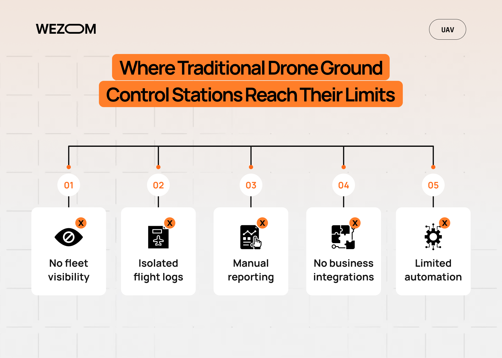
The standard GCS architecture is based on a simple "one operator->one drone->one mission" chain. However, in practice, this model faces numerous limitations, including:
- Lack of scalability. Limited visibility across the entire UAV fleet makes operational management of distributed teams impossible. GCS does not provide a complete picture of the entire drone fleet's performance, limiting itself to data on a specific device.
- Discontinuity in mission history. GCS does not create a centralized mission archive, meaning the entire flight history, weather conditions, and, of course, inspection results remain isolated in the logs of individual stations.
- Data isolation. Flight logs are stored offline, making end-to-end analysis impossible. This means businesses cannot promptly detect battery degradation or reduced UAV performance.
- Complexity in reporting. Using GCS alone requires manually uploading geospatial data for report preparation. This typically takes up 40-60% of work time.
- Lack of useful business integrations. GCS is unable to directly communicate with the company's business systems due to the lack of appropriate API connectors. This means that data transfer requires human intervention, which entails human error risks.
- Limited automation. Standard solutions don’t support AI pipelines for real-time data analysis and don’t perform the independent generation of new flight plans based on business metrics.
As the scale of the UAV fleet and the company's divisions grows, drone ground control station limitations lead to financial losses. In particular, every downtime due to untimely maintenance and every man-hour spent on manual data transfer increase the operational cost of UAV operation. Therefore, for businesses seeking maximum cost efficiency, transitioning to a model where drones and all their data are perceived as a single asset becomes the only viable strategy for staying afloat in the market. This, in turn, leads to the need for building additional software layers.
Enterprise Drone Operations Require Much More Than Flight Control
When UAV use involves more than isolated autonomous missions, basic drone ground control station software is insufficient. Instead, a multi-layered software ecosystem is required, as it consolidates piloting with business asset management. Here's what we mean.
Fleet Management
Corporations must be able to effectively manage dozens, if not hundreds, of drones. In this context, a fleet management system enables tracking the current location of all UAVs, coordinating the work of physically dispersed teams and managing drone technical parameters, including monitoring component wear, battery charge cycles, and more. This reduces the likelihood of unexpected breakdowns and extends the lifespan of the devices.
Mission Management
Transparency in mission planning is a priority. Multi-layered corporate software makes it possible to centralize flight scheduling, internal approvals, and remote assignment of missions to pilots. This eliminates human error: the software automatically remembers when and where checks are needed.
Data Management
Drones generate terabytes of data, which require their own processing system. From this perspective, enterprise software can ensure cloud synchronization of images and video archives immediately after the drone lands. For example, integration with GIS platforms allows for instant overlay of the obtained results on a site map, enabling real-time engineering analysis.
Team Collaboration
Inspection involves multiple participants (pilots, analysts, engineers, and even customers). A modern platform creates a unified workspace where each participant can see up-to-date, authorized information. Pilots receive flight assignments, analysts receive data ready for processing, and customers receive reports. This makes business processes involving UAVs seamless.
Software Components That Work Alongside a Ground Control Station
In modern corporate infrastructures, the ground control station, which handles physical communication with the UAV, is just one part of a larger technology stack. It's important to understand that additional software components in no way replace the GCS. They operate hierarchically, expanding the capabilities of the global system to include business results management:
- UAV flight mission and fleet management. While the GCS is used to keep the drone in the air and transmit telemetry, large-scale fleet management systems manage the entire lifecycle of the assets. For example, they can track the history of each aircraft, monitor the charge/discharge cycles of specific batteries, and check flight missions for standard compliance, among other things, enabling months-in-advance planning.
- AI analytics. After a mission, raw data, instead of remaining on the pilot's local drives, is automatically transferred to cloud storage. Computer vision algorithms and AI analytics can be used there to identify defects and critical deviations in the infrastructure. Overall, the cloud provides storage for petabytes of data and opens up opportunities for training neural networks.
- Remote monitoring. Modern companion computer software allows UAVs to perform complex calculations in real time, including object recognition. This means operators don't have to wait for the aircraft to land – they can monitor the mission from a central command center located thousands of kilometers away.
- Digital twins. While GCS displays the drone on a 2D map, it cannot integrate with digital twin platforms. Conversely, multi-layer software enables the overlay of survey results directly onto 3D asset models, providing operators with context that cannot be conveyed through the GCS interface.
- Web dashboards. GCS is essentially a low-level tool designed forUAV operators. Web portals, on the other hand, are tools for senior management and are capable of visualizing KPIs important to a specific business and generating real-time reporting. Ultimately, these tools enable stakeholders to make data-driven decisions based on the financial return on fleet utilization.
How Modern UAV Teams Automate the Entire Mission Lifecycle
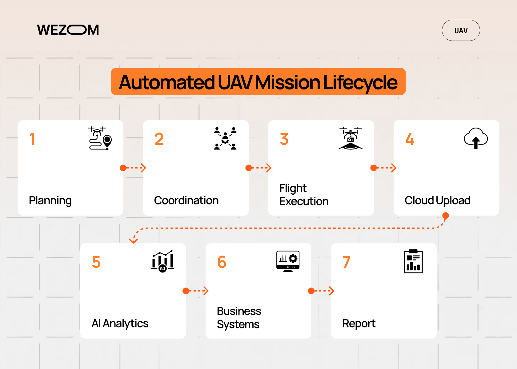
Modern UAV teams must build an automated pipeline that looks like this:
- Planning. An employee creates an inspection task in the enterprise portal, and the portal automatically generates a flight plan based on GIS data.
- Coordination. After the mission is approved by the manager, the data is automatically sent to the assigned pilot's tablet.
- Execution. The pilot executes the flight mission through the GCS, and immediately after landing, the raw data is automatically uploaded to the cloud.
- Analytics. The system runs an AI pipeline that classifies the data, which then automatically generates a report.
- Business integration. Inspection results update records in the company's corporate systems, and the client, if necessary, receives an automatic notification about the report's readiness.
As we can see, the GCS stops working upon landing and engine shutdown. It doesn't know what to do with the collected data. Enterprise software comes into play at this point, transforming the flight log into a business report.
In other words, while the ground control station for an UAV is a tool for navigating aircraft through space, other layers are responsible for generating business value from the data obtained during flight missions. Separating these responsibilities allows companies to scale: while pilots ensure flight safety, business processes are executed automatically in the cloud, minimizing human intervention.
Why Integration Matters More Than Additional Flight Features
In the enterprise segment, UAVs are often perceived as functionality bottlenecks. This is because development teams must spend a lot of resources implementing new flight modes or improving telemetry graphics, resulting in a plethora of switches in the pilot interface. Therefore, integration is the only optimal solution for transforming a "flying camera" into a fully-fledged business tool. Indeed, when drone data remains locked in the GCS, it becomes an idle business archive. Conversely, effective software must support such integrations:
- ERP/CRM systems. These integrations link the flight to a specific order or accounting object. Meanwhile, automatic recording of completed work in corporate systems eliminates the need for manual entry, while the clients receive notifications about report completion immediately after the drone lands.
- GIS platforms. Without integration, the flight mission results are nothing more than a collection of disparate photographs. This is why integration with GIS systems is so useful, as it automatically overlays the images onto geospatial maps.
- Asset management and maintenance-and-repair systems. Integration with such systems makes the UAV an effective predictive diagnostics tool. That is, if the algorithm detects severe wear on a component, the system immediately generates a repair ticket.
- Cloud storages. This connectivity is necessary for the rapid processing of terabytes of data. This means you can structure large-scale videos according to legally binding digital inspection reports.
- Business intelligence solutions. Business analytics require aggregated metrics, so integration is also useful here, as it delivers flight performance and equipment condition indicators directly to dashboards, providing ROI visibility.
- IoT platforms. A drone is essentially a mobile node for IoT solutions. Data from onboard sensors is transmitted to a shared IoT network for real-time situational monitoring.
Industries That Benefit Most From Extended UAV Software Platforms
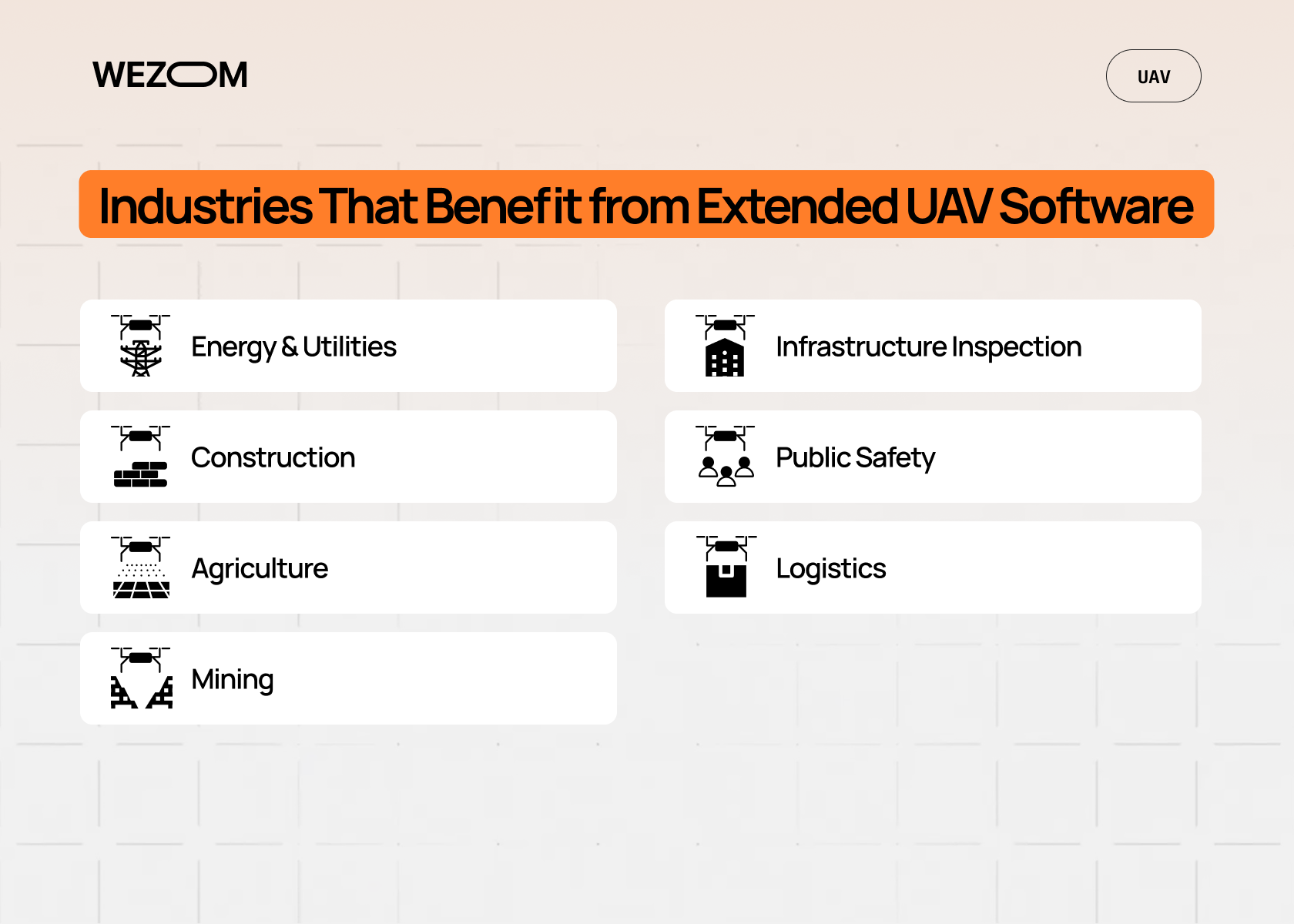
In these sectors, GCS is only capable of handling basic tasks. The primary value of UAV ground control station software lies in the add-ons that consolidate data and automate its processing.
Energy and Utilities
The challenge in these industries is the vast length of networks and the difficulty of accessing facilities. Using GCS alone, a pilot cannot detect microcracks in an insulator. This is why additional layers are needed – they will perform AI-based defect analysis linked to a GIS network map. This, in turn, enables repair planning to prevent emergency situations.
Construction
The construction industry, which uses UAVs, often faces the problem of schedule delays and discrepancies between current progress and the BIM model. GCS is insufficient to ensure pilots can safely operate the drone and engineers can compare actual data with the design. Integration with CAD/BIM, however, allows for automatic highlighting of deviations from the design, thereby minimizing rework.
Agriculture
This sector requires targeted fertilizer application and in-depth plant health analysis. GCS is ineffective for these purposes, as they imply vegetation index mapping rather than flight telemetry only. On the other hand, transferring these tasks to precision farming systems for automatic adjustment of agricultural machinery would be an excellent solution.
Mining
Typical challenges in this industry include poor personnel safety when measuring cargo volumes in deep quarries. Indeed, GCS systems are incapable of addressing this, as they are only responsible for piloting, while mine surveying is a management task. Here, additional software layers can handle the automatic generation of 3D models and cubic capacity calculations.
Infrastructure Inspection
Documenting concrete conditions with millimeter accuracy using only a ground control station for drones is impossible – it only helps support the drone but doesn't contribute to maintaining a defect registry. In this context, additional software layers could take on the task of building digital twins that allow for tracking deterioration dynamics over decades.
Public Safety
This sector requires minimal response time and rapid coordination of actions. Using a GCS alone is not suitable here, as the pilot is physically unable to transmit data to the situation center and simultaneously control the flight. Therefore, it makes sense to use a fully-fledged, multi-layered software solution that would handle real-time data transmission to the dispatch systems. This makes it possible to centralize decision-making based on up-to-date information.
Logistics
In logistics, single-tier UAV solutions cannot guarantee efficient inventory control in warehouses due to the associated human labor required for manual accounting. An autonomous drone is not enough – you need a multi-tier platform seamlessly integrated with a warehouse management system. This enables you to automate tag scanning and update inventory in the warehouse system without operator intervention.
Signs Your Organization Has Outgrown a Standard Ground Control Station
A standard ground control station is great for piloting one or two drones. But as your business scales, it leads to inefficiencies. Specifically, here's a list of the top indicators that your current UAV software architecture no longer meets your business needs, so you need to consider a modernized alternative deployment:
- You need to manage multiple disparate teams. If you feel like you're losing control of the process, it's likely that your current volume of parallel missions and operators requires a unified coordination system.
- You have a high inspection frequency. You should consider implementing additional software layers if your software can't handle the workload, as the number of objects requires daily automated flights and end-to-end data quality control.
- You need to generate regulatory reports. If you're constantly facing difficulties preparing documentation for aviation authorities, it's time to realize that GCS is no longer meeting your compliance needs.
- You waste a lot of man-hours for the manual generation of reports. Does your team spend hours transferring data from GCS to Excel? It's time to expand your software to introduce advanced automated analytics tools.
- Your data storage is disparate. If all your flight data and survey results are stored in different systems, it's impossible to quickly search and deeply analyze it. This means upgrading your existing software is inevitable.
- You constantly experience issues with your UAVs. Due to a lack of predictive analytics, are you missing maintenance deadlines, leading to unscheduled repairs and downtime for your expensive fleet? Then your GCS-only architecture is outdated.
- You don't have seamless integration between your tools. Because of this, you're forced to switch between dozens of separate services. This is just another sign that your existing software doesn't support API data exchange.
- You're suffering from disproportionately high operating costs. Inefficient resource use and manual processes make each inspection cost unreasonably high. Are you still going to delay UAV software modernization, relying solely on a ground control station?
Custom UAV Software: Building the Missing Layer Above the Ground Control Station
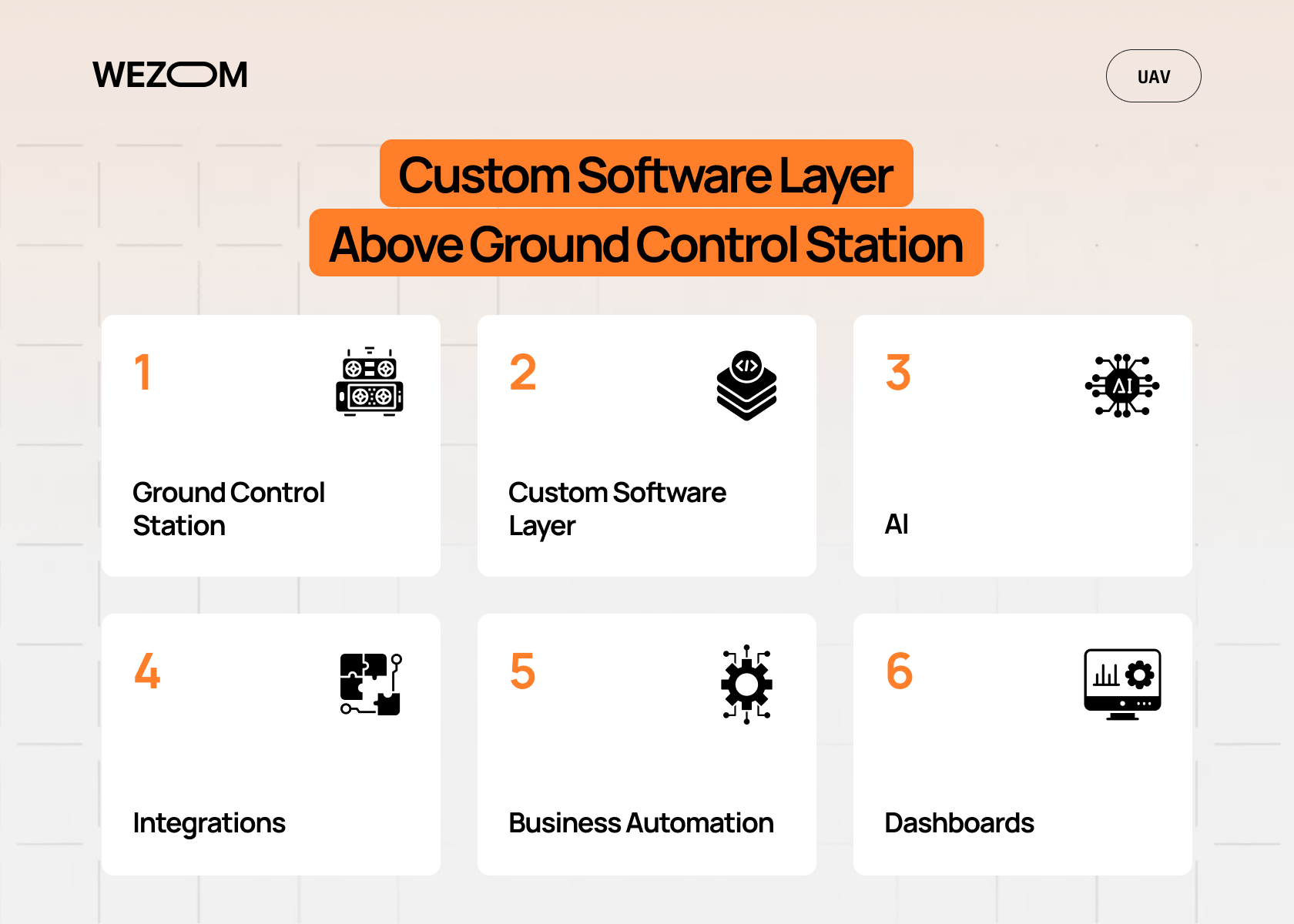
Developing a custom software layer on top of GCS allows companies to integrate disparate elements and processes into a unified whole. This is beneficial when you increasingly have proprietary workflows that aren't covered by standard solutions (for example, if you're dealing with custom payloads or performing complex BVLOS operations).
This approach also opens up opportunities for any integrations, including with legacy software; moreover, it opens up opportunities for the AI pipeline integration for real-time video stream analysis. Ultimately, custom software can transform your internal tools into white-label products or SaaS platforms.
Conclusion
A ground control station is just the basic part of a comprehensive UAV software stack, handling only real-time piloting tasks. So, if you need to gradually scale your operations with UAVs, you'll need much broader functionality, consolidating telemetry, analytics, and automated workflows into a single ecosystem. This is precisely what drives the need for custom software development, which will transform disparate flight operations into a coherent business tool.

FAQ
What are the main limitations of a drone ground control station?
Its main limitations include radio communication range, which depends on terrain conditions and physical obstacles. In addition, many standard ground control station solutions have a closed architecture that limits support for third-party sensors and prevents interface customization for highly specialized operational requirements.
Can a ground control station manage multiple drones simultaneously?
Yes. Modern ground control stations can manage UAV swarms by distributing missions across multiple drones while coordinating flight paths to reduce collision risk. Effective swarm management typically requires a powerful computing platform capable of handling complex planning and coordination algorithms.
What's the difference between a ground control station and UAV fleet management software?
A ground control station focuses on real-time flight operations, including telemetry monitoring, navigation, mission execution, and camera control. UAV fleet management software is designed for administrative and business processes such as maintenance scheduling, mission history, asset management, compliance tracking, and fleet-wide resource planning.
When should a company invest in custom UAV software?
Custom UAV software becomes a practical investment when off-the-shelf solutions cannot meet business requirements, such as supporting specialized hardware, proprietary communication protocols, strict security standards, or end-to-end workflow automation. Custom development provides greater flexibility for complex operational environments.
Can drone ground control station software integrate with ERP or CRM systems?
Yes. Integrating a drone ground control station with ERP or CRM systems enables automatic synchronization of flight data, photogrammetry results, reports, and customer records. This reduces manual data entry, improves operational efficiency, and streamlines business workflows.
