
These days, agriculture is unimaginable without centralized field monitoring. These and related tasks are typically performed from the air, using drones and specialized software. Below, we explore the functionality and architectural nuances that should be incorporated into this software to bring the highest business value.
Core Features Every Agricultural Drone Mapping Platform Should Include
Modern agriculture often uses drones in conjunction with specialized drone crop mapping software, which typically offers a number of distinctive features. We'll describe them in more detail right now.
Flight Planning & Automated Mission Management
Flight automation tools minimize the human factor, eliminating subjectivity from piloting and guaranteeing the stability of high-precision data collection. This requires the following software features:
- Autonomous flight. Thanks to this feature, UAVs perform flight missions automatically, without constant operator supervision, along a route preloaded in the onboard computer. This reduces operational costs for human personnel, minimizing man-hours and risks of accidents due to inattention.
- Waypoint planning. This feature involves determining the three-dimensional coordinates of the UAV's trajectory. This ensures uniform coverage of fields of absolutely any geometry without gaps or overlapping scan zones.
- Terrain following. Such functionality requires the implementation of highly intelligent altitude control algorithms that allow the drone to adjust its flight in real time to changes in terrain elevation. This ensures consistent image resolution and pixel size on the ground, guaranteeing accurate mapping.
- Repeatable missions. This is a feature for saving and replaying flight tasks. It allows drones to glide along a trajectory calibrated to the centimeter after a certain period of time, thereby opening up opportunities for real-time monitoring of crop growth dynamics, seedling germination, and the effectiveness of treatments at each stage of the season.
- Obstacle avoidance. This is achieved through a complex of onboard sensors and computer vision algorithms that scan the surrounding area in real time, protecting drones from collisions with trees, power lines, and other obstacles. This feature protects agribusinesses from unexpected losses and cash flow shortfalls due to equipment damage.
High-Resolution Image Processing
Raw footage from a drone's onboard cameras represents a big array of disparate files, from which the average agronomist cannot extract any business value. Therefore, the software must include the following features:
- Orthomosaic generation. Stitching thousands of frames into a single, geometrically accurate terrain map, free of perspective distortion and camera tilt, requires the implementation of complex mathematical algorithms. However, thanks to this, agribusinesses obtain a unified digital field map with centimeter-level accuracy.
- Image stitching. This involves frame-by-frame analysis algorithms that combine overlapping image areas, eliminating shadows, illumination differences, glare, and discontinuities in the map surface.
- Georeferencing. Integrating telemetry data from onboard RTK/PPK modules ensures that every pixel on the map is linked to the global coordinate system with an accuracy of no more than a few centimeters. This allows agricultural specialists to transfer data to the onboard computers of heavy agricultural equipment for targeted fertilizer application only in areas where problems have been detected.
- Cloud processing. This involves offloading resource-intensive computing tasks to remote cloud servers. This eliminates the need for agricultural companies to invest millions in expensive supercomputers for local data processing.
- Data accuracy. Such a feature refers to the detail and geometric accuracy of maps to eliminate false positives during automated field monitoring. This protects the company's budget from unnecessary spending on excessive chemicals and eliminates the need to treat healthy areas.
Multispectral & Thermal Data Support
Analyzing reflected sunlight in spectral ranges invisible to the human eye opens up expanded monitoring capabilities. It also makes it possible to identify hidden plant problems before they become apparent through routine inspection.
- NDVI. This index evaluates the overall density and growth rate of plants. It allows for the immediate detection of areas with stunted seedlings on digital maps.
- NDRE. The index uses the narrow red edge of the spectrum and assesses the condition of crops in the late stages of development, when NDVI can go off-scale due to leaf closure.
- Thermal imagery. It implies the recording of temperature anomalies in the underlying surface using onboard thermal imagers. It is responsible for identifying water and heat stress, both natural and caused by malfunctions in irrigation and automatic irrigation systems.
- RGB imagery. This functionality uses ultra-high-resolution color photographs for comprehensive visual monitoring of weeds, soil erosion, mechanical damage to crops, and more.
- Vegetation analysis. It includes a multi-factorial assessment of field conditions, enabling accurate forecasting of crop yields and required fertilizer applications.
- Crop stress detection. This involves early detection of diseases, nitrogen deficiency, and drought, several weeks before visible symptoms appear on the leaves. The feature makes it possible to save crops from failure.
AI-Powered Crop Health Analysis
The integration of AI/ML into drone-based solutions brings end-to-end automation to agricultural analytics. Instead of manually assessing thousands of hectares of orthomosaics for defects, algorithms scan every pixel, identifying hidden pathologies at early stages before they can cause irreparable damage to the crop. The following features fall into this category:
- Disease detection. Computer vision algorithms recognize patterns of leaf and stem damage caused by various infections, allowing for localized treatments instead of spraying the entire field with fungicides.
- Pest identification. AI analyzes insect pest traces and leaf damage, enabling pest identification and selection of appropriate insecticides.
- Nutrient deficiency. Spectral deviation analysis (in particular, identifying changes in foliage color) is used to diagnose macro- and micronutrient deficiencies in specific areas of the field.
- Anomaly detection. Automatic scanning for deviations from the norm (including damage from machinery and weather events) allows for timely application of fertilizer to affected areas of the field.
- Predictive analytics. This refers to forecasting based on historical data and vegetation rates, with the aim of modeling yield scenarios.
- Machine learning. These are self-learning models that improve their pattern recognition accuracy over time, taking into account regional specifics (soil types, crop varieties, etc.).
GIS & Farm Management Integration
The business value of a specific drone mapping platform increases when it can seamlessly integrate with other systems used by a specific company. As a result, data collected by drones is synchronized with ground equipment and corporate databases. The most useful integrations include:
- GIS platforms. This integration enables overlaying maps with cadastral field boundaries and topographic layers.
- ERP systems. Seamless integration with these systems allows employees to automate cost accounting for fuel, seeds, fertilizers, and shift work, taking into account the specifics of specific sites.
- Farm management information systems. Data exchange with such systems ensures instant updates of process maps and field work plans.
- GPS equipment. This refers to the transfer of digital layers and maps to the onboard computers of heavy robotic equipment with guidance systems.
- IoT sensors. Combining aerial photography data with soil moisture and temperature sensor readings improves irrigation planning.
- Weather platforms. Taking into account weather forecasts and wind speeds helps plan flight missions.
- Satellite imagery. Combining drone data with satellite imagery opens up opportunities for retrospective analysis and macro-monitoring of large tracts of land.
Prescription Map Generation
Since the commercial benefit of using drones in agronomy lies in the ability to transform collected data into practical insights for farming, the precision agriculture drone mapping software must have the following prescription capabilities:
- Variable rate application. This involves generating electronic maps for real-time control of material consumption based on plant needs per square meter.
- Fertilizer optimization. This enables the distribution of mineral fertilizers by fertility zones (i.e., areas with good yields receive less fertilizer, while areas with low yields receive as much as needed to maximize yield potential).
- Irrigation planning. Such planning helps promptly identify dry zones using temperature maps and moisture indices. This, in turn, enables dynamic adjustment of drip irrigation systems and pivot irrigation machines.
- Pesticide application. This involves creating point maps for weed and pest control, reducing the pesticide load on the environment.
- Precision spraying. This feature reduces agrochemical costs by applying treatment only to infested areas using spot-spraying technology.
Real-Time Analytics & Dashboards
To make sound management decisions, agronomists need a user-friendly interface that consolidates all information in real time. Specifically, this applies to:
- Key performance indicators. These include the main metrics for agribusiness, including biomass growth dynamics, resource consumption, cultivated area, projected yields, etc.
- Field comparisons. This feature includes tools for cross-analysis of crop rotation efficiency and different fertilization schemes between different fields.
- Historical analysis. This refers to comparing current indicators with data from previous years to assess soil degradation or restoration.
- Productivity reports. Here, it is important for the software to be able to generate analytical summaries for investors and department managers in one click.
- Interactive maps. Ultimately, the interface of the agriculture drone mapping software you choose should have the ability to zoom, layer indices, and view data about any point in the field directly from a mobile device (preferably in the field).
Advanced Features That Differentiate Modern Drone Mapping Software
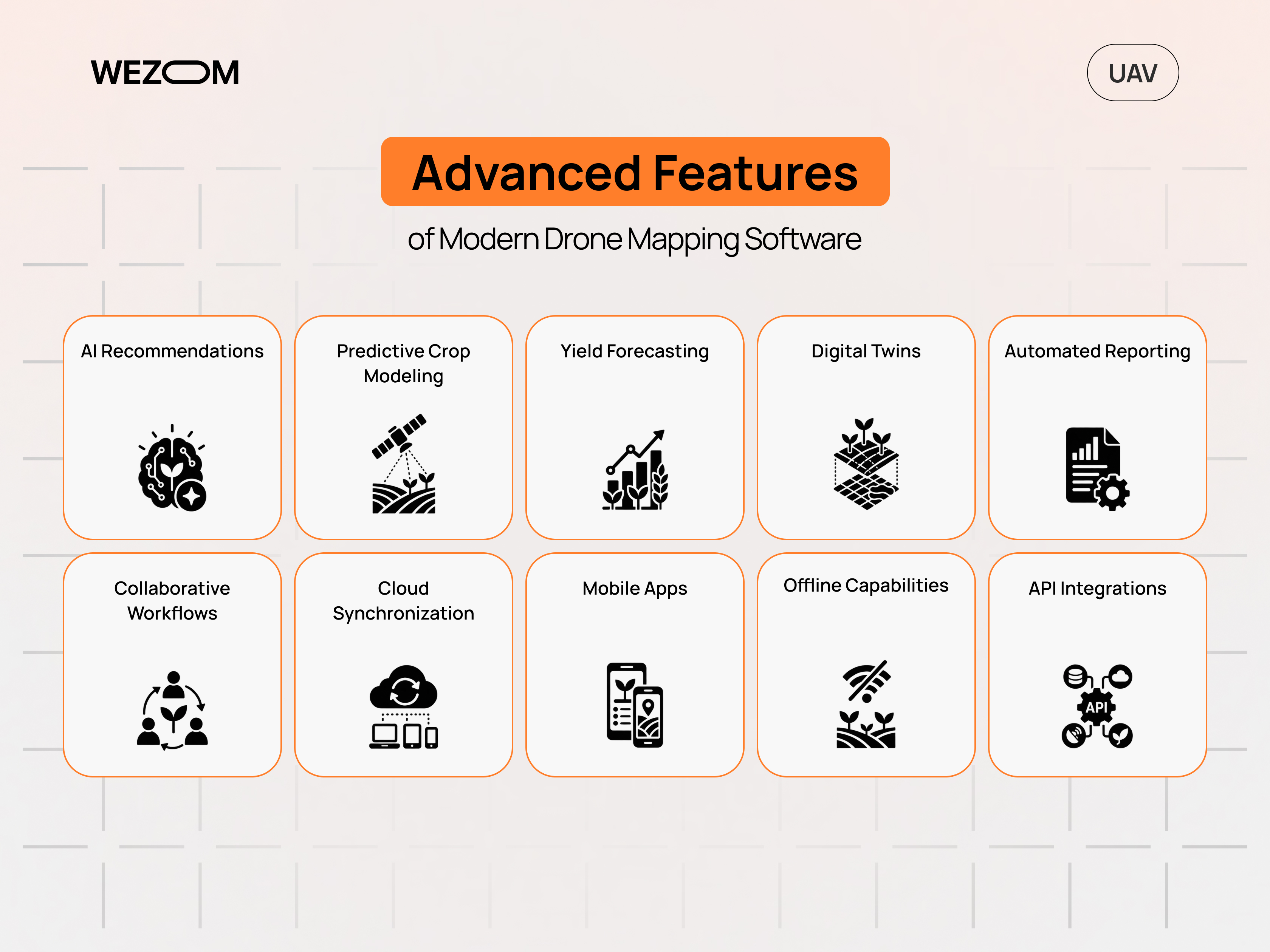
In addition to the functionality described above, top-tier solutions also offer the following set of features:
- AI-powered recommendations. These platforms can provide expert advice on preventing negative outcomes. In particular, they can suggest the best time to apply fungicides and where to reduce nitrogen fertilizer application. All these recommendations are generated based on historical patterns and current data collected by drones.
- Predictive crop modeling. This involves forecasting the phenological stages of plant development and their response to external stress factors such as drought, frost, and pest infestations. Real-time climate change is also taken into account.
- Crop yield forecasting. This functionality accurately calculates the gross crop yield before the harvesting campaign begins. This allows agricultural holdings to plan logistics and heavy equipment capacity in advance, which, in turn, simplifies the conclusion of supply contracts.
- Digital twins. Digital twins are the creation of virtual 3D copies of a farm's land bank. This enables remote and secure testing of any agronomic hypotheses.
- Automated reporting. It's important for the software to generate analytical summaries and investment reports in one click, based on preset templates.
- Collaborative workflows. To implement these capabilities, the software must support the simultaneous operation of both office and field staff (including drone pilots), with appropriate access rights assigned.
- Cloud synchronization. The cloud ensures instant transfer of flight assignments and maps between tablets and the central office via secure servers.
- Mobile applications. These are necessary so that field specialists can check prescription maps and assign tasks to other specialists while patrolling the fields.
- Offline capabilities. This is necessary to ensure the software can operate in fields with unstable internet coverage and be able to retrieve collected data once the network is available.
- API integrations. Essentially, these are open software interfaces that allow the drone platform to be connected to weather stations and any third-party agricultural software.
Choosing Drone Mapping Software for Different Agricultural Operations
Different scales of agricultural production dictate different requirements for agricultural drone mapping software architecture. For example:
- Small farms require user-friendly cloud solutions with a basic set of functions (e.g., orthomosaic, simple NDVI, and fast report export) to eliminate the need for full-time surveying specialists;
- Medium-sized farms need solutions with advanced analytics, compatible with multispectral cameras and existing equipment fleets, to optimize seed and insecticide/fertilizer costs;
- Large agribusinesses and holdings require powerful enterprise platforms with multi-user access, predictive analytics, numerous connectors, and guarantees of strict data cybersecurity;
- Agricultural service providers must have software that can handle large data sets at high speed, customize reports, as well as support billing and multi-project management;
- Cooperatives require highly scalable architectures with distribution of rights among independent participants of the association.
Common Mistakes When Selecting Agricultural Drone Mapping Software
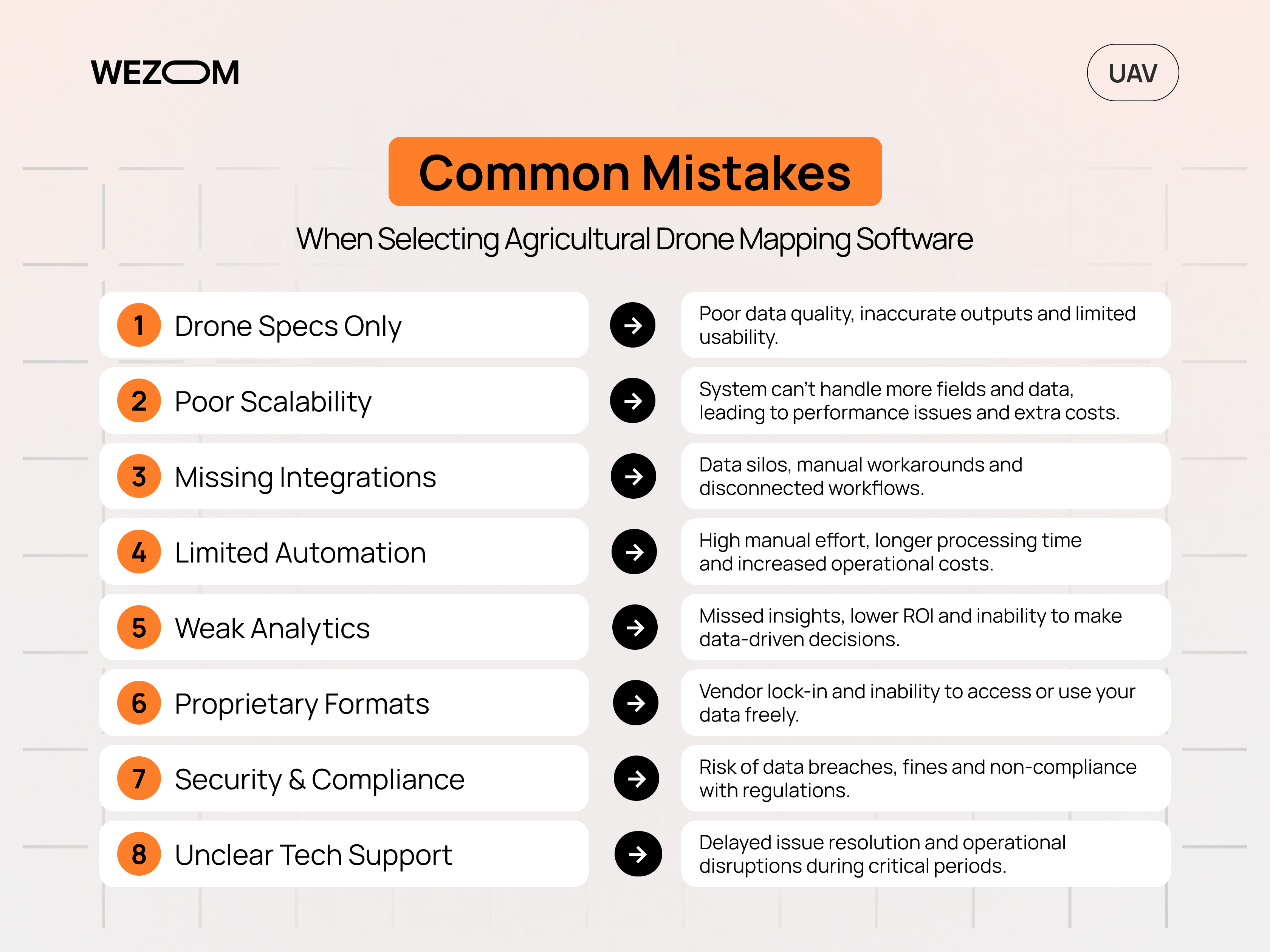
So, how can you choose the right software for drone-based agricultural monitoring? It's important to recognize a number of common mistakes when searching:
- Relying solely on drone specifications, without considering the quality of its stitching algorithms and export formats;
- Ignoring scalability, which could mean the chosen solution can't handle the growth of field areas and, consequently, the data required for them within a year or two;
- Failing to consider integrations that may be needed in the future (for example, with onboard computers of agricultural machinery and/or legacy FMIS/ERP systems);
- Being limited in automation capabilities, which could require a significant amount of time manually optimizing each frame and georeferencing points;
- Underestimating the capabilities of analytics – for example, many solutions today go far beyond processing RGB images and utilize AI;
- Accepting the inability to process proprietary data formats;
- Not taking into account industry/regional security requirements (usually, this means data encryption and compliance with local standards for protecting confidential agricultural data);
- Not specifying tech support terms, which can easily lead to delays in vendor assistance during the peak field season.
Build Custom Drone Mapping Software or Buy an Existing Platform?
Now, let's compare a number of aspects that are worth analyzing before you either choose a ready-made solution or start development from scratch.
| Criteria | Custom software | Off-the-she+9+lf solutions |
|---|---|---|
| Customization | Maximum flexibility and the ability to adapt to unique business processes | Limited to standard vendor functionality |
| Implementation speed | Low: requires a full development cycle lasting months or years | High: you can start work on the day of license purchase |
| Ownership | Full source code ownership | Rental |
| Licensing | No recurring subscriptions to third-party software (although there are support costs) | Recurring payments per user/hectare |
| Scalability | Depends on architecture and investments in optimization | Proven, fault-tolerant infrastructure tested by thousands of users |
| Integration flexibility | Ability to integrate with any system, including legacy systems | Depends on the availability of ready-made APIs from the vendor |
| Long-term costs | High initial investment and ongoing support team costs | Predictable operating expenses that grow with the scale of your business |
| Competitive advantage | Creation of unique technology unavailable to competitors | Use of industry-standard practices accessible to everyone |
Conclusion
The main value of UAV-based digital platforms lies in their ability to seamlessly transform terabytes of aerial imagery into solutions for precision fertilizer application and crop protection. This means that agriculture can significantly reduce the risk of excessive chemical load and maximize yield per square meter.

FAQ
What is agricultural drone mapping?
This is the process of collecting geospatial data using UAVs and specialized software for photogrammetric processing of images and the subsequent construction of digital elevation models and crop health maps.
How does precision agriculture drone mapping improve crop management?
This opens up opportunities for predictive agricultural monitoring, i.e., identifying problems such as drought or weeds at an early stage. Specialists receive VRA maps for targeted field treatment, which saves 20-40% on fertilizers and/or pesticides within the first few months of implementation.
Which sensors are best for drone crop mapping?
The choice depends on the task: multispectral cameras are used to calculate vegetation indices and detect hidden plant diseases, thermal imagers to monitor temperature anomalies and irrigation systems, and RGB cameras for general visual monitoring and germination control.
What is NDVI mapping, and why is it important?
The normalized difference vegetation index measures seedling density and total plant mass, enabling the immediate detection of areas of stunted or damaged crops in fields.
Can drone mapping detect crop diseases early?
Yes, ML-based solutions use multispectral imaging to detect even the slightest changes, such as signs of disease and nitrogen deficiency, within 1-2 weeks, before symptoms are visible to the human eye.
